
Project :: Goldhill
Gold, Silver, Copper
Nelson, B.C.
 If the historic government records are accurate, the Gold Hill Prospect holds the potential of a significant deposit of gold, silver and copper. The prospect, located on the eastern side of 49 Creek south of Nelson BC, was discovered in the 1890s and went into production in 1898.
The following is an excerpt from the 1927 Annual Report of the Minister of Mines of British Columbia (Pages C136-C137) on the Gold Hill:
Three distinct veins are indicated by the underground workings, which in the aggregate amount to some 2,000 feet. The principal working (No. 1 vein) consists of a crosscut  tunnel some 560 feet in length, from the end of which tunnels branch out in various directions. Most of the tunneling has been done along dykes, fault-fissures and slip planes
In the year 1903 about 5 tons of ore was shipped to the Hall Mines smelter from the surface above this vein which assayed: Gold 1.26 oz. to the ton, silver 1.6 oz. to the ton.
tunnel some 560 feet in length, from the end of which tunnels branch out in various directions. Most of the tunneling has been done along dykes, fault-fissures and slip planes
In the year 1903 about 5 tons of ore was shipped to the Hall Mines smelter from the surface above this vein which assayed: Gold 1.26 oz. to the ton, silver 1.6 oz. to the ton.
No. 2 vein at a vertical depth of about 300 feet from surface is cut off by a lamprophyre dyke at the northern end of the Gormley stope. Below this stope there is a winze from which about 3 tons of ore was shipped to the Hall Mines smelter in 1903, the assay for which was: Gold, 4.12 oz. to the ton; silver 2.3 oz. to the ton. From the same winze in July 1922, some leasers shipped about 9 ¼ tons to the Trail smelter which assayed: Gold, 1.99 oz. to the ton; silver, 1.5 oz. to the ton; copper 1.4 percent.
From above the level G. Gormley shipped ore in 1921 and January 1922, extracts from the smelter returns for this ore being as follows: - February 1921, gross weight 66,800 lb.: Gold, 2.735 oz. per ton; silver, 1.6 oz. to the ton; copper, 1.18 percent.
October 1921, gross weight 53.8 tons containing: Gold, 127.671 oz. to the ton; silver, 83.68 oz. to the ton; copper, 1,017 lb. January 1922, gross weight, 40,770 lb.: Gold, 1.46 oz. to the ton; silver, 3.5 oz. to the ton; copper, 2.78 percent.(1)
Due to the historical nature of the report, the above records and grades are not NI 43-101 compliant. In addition, the Gold Hill Minfile 082FSW092 contains very sparse information on the property and a lower record of production and grades.
The 1927 Annual Report of the Minister of Mines gives much more detail including an informative record of the local geology, excerpts from which are as follows:
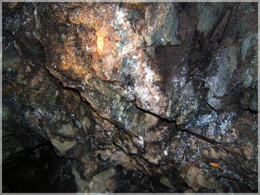
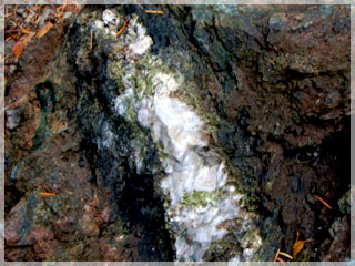
 The Gold Hill tenures are underlain by massive to schistose dark green andesites as an augite porphyry rock. There are numerous fault zones mostly filled with kaolinized gouge material. Veins occur as zones of pegmatic quartz and feldspar with minor chalcopyrite, bornite and free gold. Numerous sheared diabase dikes occur throughout the property and in some cases have been sheared so much that they are of a kaolinized-biotite schist texture. The vein zones around the workings are up to 0.75 meters in width and follow well defined lines of cleavage. The gangue material is quartz with pyrite, arsenopyrite, chalcopyrite, bornite and chrysocolla mineralization. Oxidized veins were found to contain malachite, azurite with some free gold. The main assay value results are mostly for gold, with little silver and copper. (Annual Report Minister of Mines, 1927)
In 1923 one of the early owners is reported to have perished in a cave-in in the Gormley Stope and except for a small amount of mining in 1925, (12 tons), the property remained idle until 1983 when a small exploration program (34 soil geochemical samples) was conducted which was followed by a few other small exploration efforts (1984, 1988 and 1990).
 The highest assay from exploration in 1984 was 188.16 g/t gold, 152.7 g/t silver and 4.24 % copper near the main adit entrance (GBAR # 13878). Meanwhile, an underground assay on the southern extent of the # 2 vein averaged 6.95 g/t gold over an average width of 2.94 meters (not 43-101 compliant). The sampled zone was along strike for a distance of 9.15 meters (GBAR # 13878). A channel sample taken in 1988 from a trench on the structure assayed 25.1 g/t gold (MINEFILE # 082FSW092).
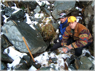
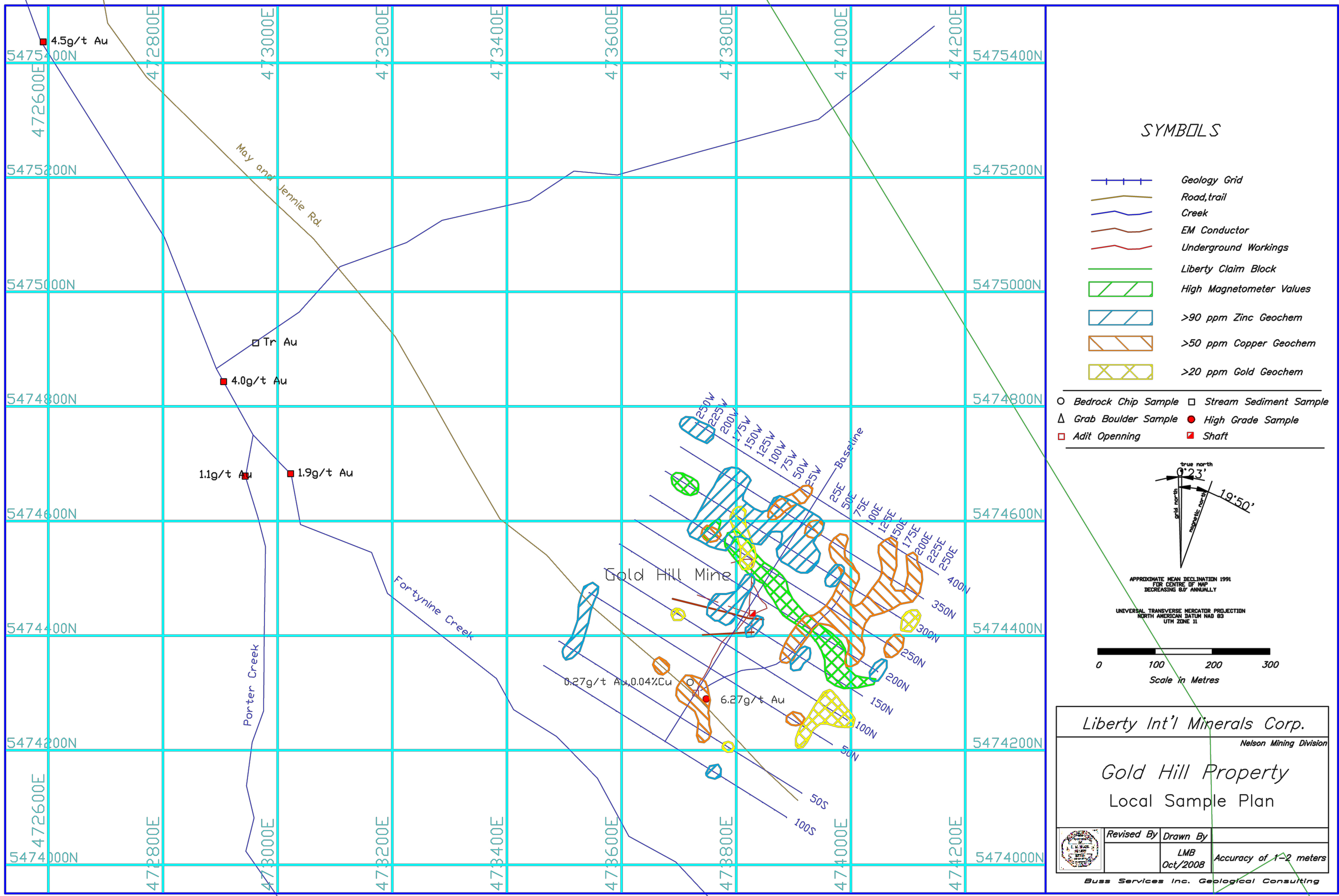
A single surface chip sample collected by L. Buss PGeo about 30m along strike east of the old adit during an August 2008 site visit returned a value of 6.27 g/t Au. (2)
Comparison of Gold Hill Chip Samples
| Sample # | Au (g/t) | Ag (g/t) | Cu (%) | |
| 1984 Chip Samples | GHP84-1 | 116.6 | 5.0 | 0.11 |
| GHP84-2 | 188.2 | 152.7 | 4.24 | |
| GHP84-3 | 10.2 | 35.8 | 0.70 | |
| 2008 Chip Sample | 203685 | 0.27 | 1.8 | 0.04 |
Quite a lot of exploration has been conducted around the old workings and could serve as a signature for other similar deposits in the area. For example, magnetic highs are coincident with the EM conductors and parallel the faulting. Copper soil anomalies are concentrated sub-parallel to the veining. A large zinc soil anomaly, in conjunction with a smaller gold anomaly, is situated on the hanging wall side of the ore shoots. Another anomalous gold geochemical signature is located to the southwest of the workings and is untested. The magnetic high signature appears to be along strike towards the anomalous stream sediment on Porter Creek which assayed 4.0 g/t gold.
 A limited underground sample plan (GBAR # 12,486) showed that there is currently insitu gold mineralization throughout the workings, some grading up to 16.8 g/t gold over 0.75 meters. Burton (1983) stated in his report that the workings on the mineralized veins themselves averaged one ounce of gold or better from old reports. Also, that the gold mineralization extends over 200 meters horizontally and at least 90 meters vertically.
The main vein (Gormley stope) in the central portion of the workings contained the highest grade of ore. A total of 109 tonnes was extracted at an average grade of 1,822 g/t gold, 1,206 g/t silver, 1.34 % copper (Minister of Mines report 1927). The report further states that the upper section of the stope (98 tonnes) was cut off by a dike.
Therefore there is a good probability that a high grade low tonnage deposit exists in the area. The major targets are along strike and down dip/plunge.
The property has never undergone systematic exploration and reportedly no drilling has ever been done on it making the Gold Hill a highly prospective property in Libertys portfolio.
 The Gold Hill Mine tenure is ready for drilling to investigate resource shoot extensions away from the old mine workings. It is therefore recommended to drill the extensions of the Gormley stope and the south vein. Due to the narrow nature of the shoots, only a couple of thousand meters of diamond drilling would be required for testing and potential resources.
Good accessibility to the prospect area has been created by sporadic logging and infrastructure is excellent with the town of Blewett approximately 8 kilometers away. A large hydro generation station is immediately north of the property on the Kootenay River and railway and transportation is conveniently located along the highway #3 corridor.
- Annual Report of the Minister of Mines of British Columbia 1927 (Page C136-137)
- Eco Tech Lab_Certificate of Assay AK 2008-1206