Project :: Greenhorn
Copper, Silver
Nakusp, B.C.
 The Green Horn Copper Project is located approximately 12 km north of the town of Nakusp, B.C. on the west bank of Arrow Lake and is highly prospective for a significant deposit of copper with some associated silver.
It is the second most advanced of Libertys Canadian projects and is immediately ready to commence drilling.
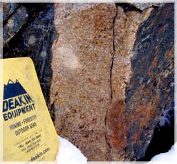
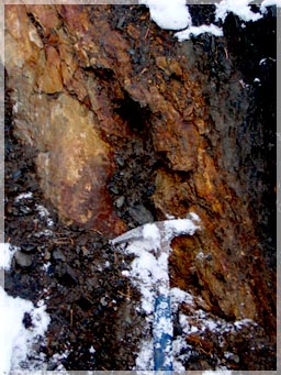 The Green Horn property was first explored at the turn of the century and led to the discovery of a copper mineralized zone around the Dunn Creek area which is the main showing in the center of the claim group.
Historical records contained in the 1902 Annual Report of the BC Minister of Mines reports samples of 16% Cu and $2/t Au (Orphir Group assessment report on Cape Horn mineralization_ Report of Minister of Mines BC 1902 issue page 1036)
The 1904 Annual Report records 8% CU and $2/t Au. (Cornwall Group assessment work report near Cape Horn_Report of Minister of Mines 1904 issue page H-150)
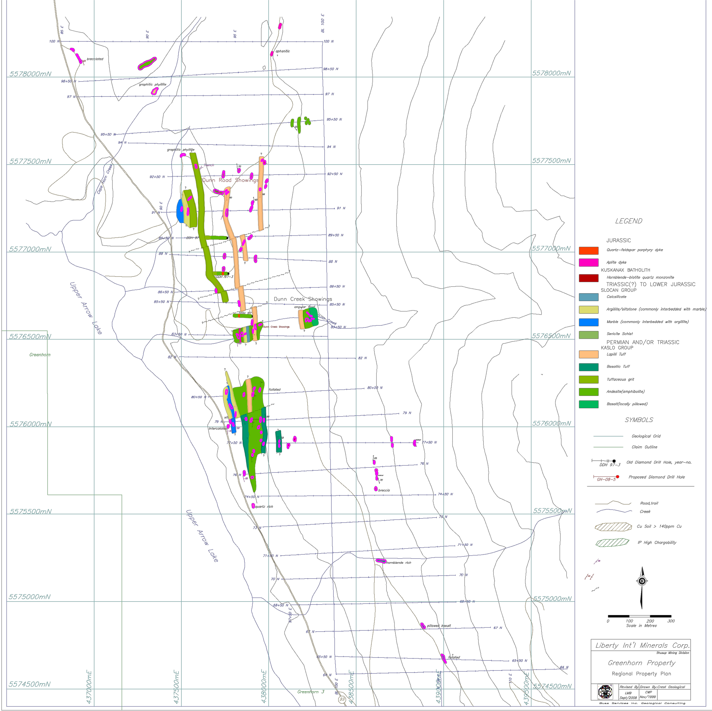
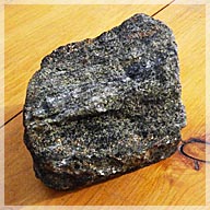
The Greenhorn tenure package lies along the west edge of the cretaceous age Kuskanax batholith composed of aegirine-augite quartz monzonite (Ferguson, 1990, GBAR # 21,289). Metavolcanic rocks of the Paleozoic to Triassic Kaslo Group, mainly amphibolites and gabbroic units are overlain in the west-southwest by Triassic Slocan Group. This metasediment package is composed of phyllite, siltstone and limestone. Felsic porphyry dikes crosscut the layered units over the central portion of the property (Ferguson, 1990).
Greenhorm Intrusive
Units and Bornite
The Greenhorn property was first explored in the 1903 and led to the discovery of a copper mineralized zone around the Dunn Creek area. Three diamond drill holes were drilled in 1960 for a total of 47 meters (Minfile # 082KSW124). A geochemical survey was conducted around Dunn Creek in the same year as the short drilling program. A major uranium exploration program was initiated on the property in 1978 with the creation of property wide scintillometer contour map. This program was expanded in 1979, to include geological mapping, magnetometer and a copper-lead geochemical survey.
 The most recent work included a geophysical IP survey over the property along with a copper geochemistry program.
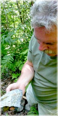
In 1990 an exploration program was conducted by D. Ferguson on the Greenhorn property. The program consisted of a 109 sample geochemistry program and an 18 rock sampling/mapping program.
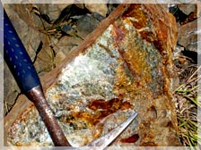
The small program of 109 geochemistry samples and 18 rock samples in 1990 yielded sample values up to 3.14% copper and 18.1 g/t silver 700 meters north of Dunn Creek. Phelps Dodge optioned the property and the highest value of 31 rock samples from the Dunn Creek Trench collected by Phelps Dodge in 1999 was 5.74% Cu. (Phelps Dodge 2000 Assessment Report – page 7)
Phelps Dodge drilled 3 short holes north of Dunn Creek (1999). The three basically wild cat exploration holes had limited success as they apparently drilled between the since further defined and mapped three potential mineralized lenses. Phelps geologists recommended more work but the option was dropped reportedly to prioritize other projects.
The southern tenure area is complete with a surface grid, soil geochemistry, geological mapping, and geophysics. A reinterpretation of the data led to the identification of four drill targets, which have yet to be drilled. The previous diamond drilling in 1997 was not 43-101 compliant in terms of QA/QC methodology and sampling techniques. The drill core from the program is piled on site and lacks markings and/or hole identification.
A thin section petrographic report was completed on a rock sample from the Dunn Road showing. The findings showed that “this metamorphic rock could correspond to the type of material expected in a stringer zone at the base of a Volcanic Massive Sulphide type deposit” (Leitch, 2003). What is also interesting to note is that a large (>1.0 m) linear massive zone of pyrrhotite occurs on the property along the footwall contact of the sediments and the volcanics. Although this lense is barren of copper, it does suggest a vent conduit, potentially mineralized at depth. Therefore the potential exists for a large tonnage – medium grade Cu/Ag deposit within the tenures.

 The Greenhorn south central tenure is the second most advanced of Liberty’s Kootenay properties in terms of geological exploration. The previous four holes were scattered throughout the footwall of the property with poor orientation, even though the structure was well defined. It is recommended to drill the hanging wall zone around Dunn Creek first, followed by the massive sulphide footwall zone. It is estimated that 5,000 meters to 10,000 meters of diamond drilling would be required to bring this property into a drill indicated mineral resource category.
Liberty has mapped out 7,600 meters of drilling in two phases (South and South Central Plans) for the Greenhorn copper project, short equipment access trails off the main logging roads and drill pads have been flagged, an application for a drill permit is in process and drill rigs are readily available.
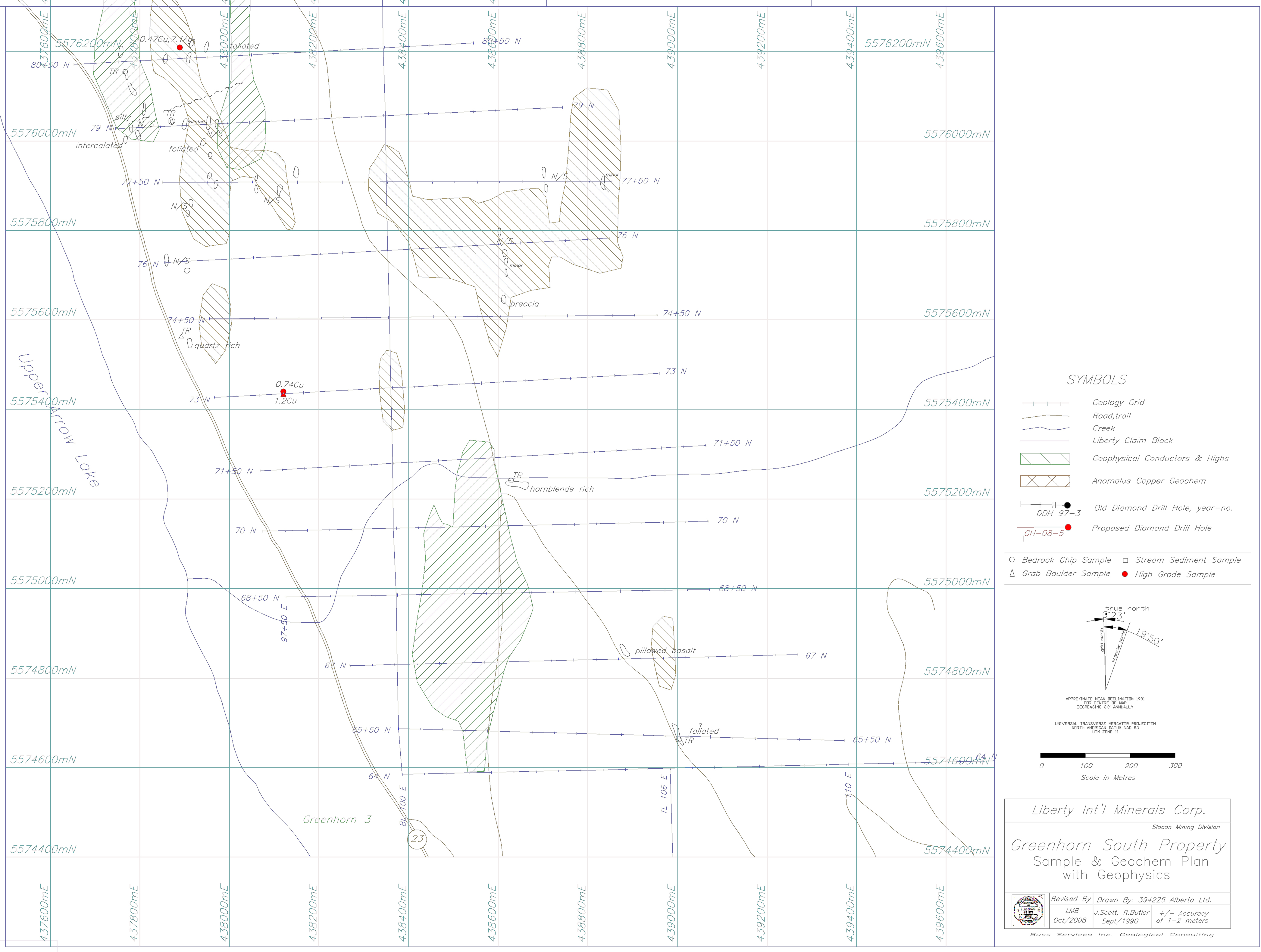
Greenhorn South Sample Plan
The potential of a significant copper discovery is very good as indicated by field work coupled with the historic records contained in the Annual Ministry of Mines reports. The projected budget for the Greenhorn drill program including a drill indicated resource calculation is $1,375,000 Canadian.
Infrastructure in the area is excellent with Highway 23 extending along the entire western edge of the claim group and hydro passing alongside through the area parallel to Arrow Lake. Accessibility to the area is quite good with abundant logging roads throughout and average amounts of snowfall making year round access to the project area possible.