Project :: Lanark
Gold, Silver, Lead, Zinc
Revelstoke, B.C.
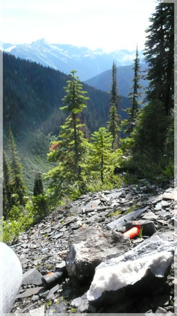 The Lanark Project is located on the southern slope of Fidelity Peak approximately 45 km northeast of the City of Revelstoke BC. The prospect has high potential for the discovery of a significant polymetallic deposit of gold, silver, lead, zinc and copper.
The Lanark was first discovered by early prospectors in 1883 and was immediately developed. In 1888, an inclined shaft was mined on the main vein for 30 meters. The underground development/mining of 243 meters progressed through to 1893 (Minfile # 082N 012). All the broken ore was eventually extracted and work was suspended prior to 1900. The site was reactivated from 1915 to 1923 after some new mineralized zones were discovered.
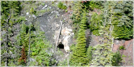
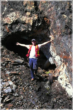 The Lanark tenure mine workings consist of two internal winzes and three adits of unknown size. A 1918 cross section of the mine workings show that the adits are spaced at 45 meter intervals towards the top of the mountain (Dasler, 1981). The section also shows a lower haulage tunnel, approximately 183 meters in length, to the lower winze. The entire mined out zone covers an area of 137 meters down dip and 15 meters thick. The width of mined area appears to be in the 2 – 3 meter range.
The top two upper adits were undeveloped because of the mineralized zone reaching the surface between adit 1 and 2. The surface width of the zone was listed as 7.6 meters with an apparent thinning out on the lower levels to 1.5 meters.
The total documented production was 801 tonnes @ 1,296g/t Silver, 0.04 % Lead and trace gold from 1914 to 1922. Production is summarized in the table below and all figures are not 43-101 compliant.
As stated, the entire mined out zone covers an area of 137 meters down dip and 15 meters thick with a total documented production of 801 tons @ 1,038,374 g silver, 217 g gold, and 292,781 pounds lead from 1914 to 1922. As these are historical records from the Lanark Production Summary (MINFILE # 082N012) all the figures are not NI 43-101 compliant.
Lanark Production Summary
| Year | Tonnes Mined | Tonnes Milled | Mineral | Gms Recovered |
| 1914 | 59 | 59 | Ag | 135,547 |
| Au | 124 | |||
| Pb | 17,265,000 | |||
| 1915 | 55 | 55 | Ag | 63,077 |
| Au | ||||
| Pb | 18,788,000 | |||
| 1916 | 371 | 371 | Ag | 273,520 |
| Au | ||||
| Pb | 66,825,000 | |||
| 1917 | 189 | 189 | Ag | 345,368 |
| Au | ||||
| Pb | 118,680,000 | |||
| 1919 | 25 | 25 | Ag | 46,157 |
| Au | 31 | |||
| Pb | 14,313,000 | |||
| 1920 | 54 | 54 | Ag | 89,825 |
| Au | ||||
| Pb | 30,208,000 | |||
| 1922 | 48 | 48 | Ag | 84,880 |
| Au | 62 | |||
| Pb | 26,702,000 |
 It is unknown as to the amount and degree of exploration that has been done on the property since 1925. One report by Chapman in 1990 (# 21,390) contained a mapping project of the area for Adrian Resources. They also conducted a geochemical program along with a surface chip sampling program around the adits with the highest chip sample returning values of 2.5 g/t Silver, 15.30% Zinc and 11.50% Lead.
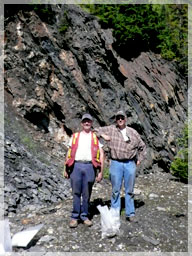
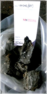
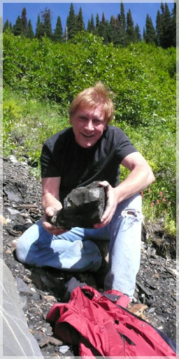
The property was visited by helicopter in September 2008 by Liberty and a few chip samples collected by L. Buss PGeo of which the two highest recorded values were 338 g/t silver, 11.2 % Zinc and 9.86% Lead and 256 g/t Silver, 9.80% Zinc and 7.47% lead. The table below shows some of the 1990 higher grade values around the helipad compared to the samples taken in 2008.
| Sample # | Ag (g/t) | Zn (%) | Pb (%) | |
| 1990 Chip Samples | 8020 | 105.1 | 27.8 | 1.96 |
| 8022 | 458.1 | 15.30 | 11.50 | |
| 8024 | 22.5 | 10.91 | 1.18 | |
| 8026 | 316.9 | 2.06 | 9.65 | |
| 2008 Chip Samples | 203654 | 338.0 | 11.20 | 9.86 |
| 203655 | 256.0 | 9.80 | 7.47 | |
| 203656 | 82.4 | N/S | 2.40 |
 The highest value 2008 grab sample collected by L. Buss from outside adit #1 graded 1,206 g/t silver, 38.5% lead, 21.5% zinc and the highest chip sample outside adit #@ 9.61 g/t Au, 256 g/t Ag, 7.47 % Pb, 9.8% zinc.
The old Isabella mine is located approximately 300 meters down-slope from the Lanark mine and an excerpt from the Annual Report of the Minister of Mines of British Columbia for the year ending 1882 states, “Some very fine Argentiferous Grey Copper yielded samples as high as 2,600 oz/ton Silver.”
On a regional scale, the geology of the Lanark tenure package is underlain by thinly bedded, dark slates interbedded with thin laminates of argillaceous limestone. The slates have been determined to be of Lower Cambrian while the limestone is of the younger Lardeau Group. A major folding sequence of anticlines and synclines occur throughout the area, striking in a northwest southeast direction.
 Locally, within the Lanark deposit, are mineralized replacement type quartz veins with massive, argentiferous galena, sphalerite, pyrite and minor tetrahedrite and chalcopyrite (Minfile # O82N 012). The gangue material is a highly silica altered limestone. The ore veins are intensely folded with an average dip of 40 degrees to the northeast. Field investigation showed the zones to be striking at 275 degrees with a 58 degree dip to the northeast. Apparent plunges were measured at 30 degrees to the east.
Old sections show that the Lanark mine area has been extracted at full width down dip 80 meters towards the park border. It is unclear at this point as to why the mining was not extended deeper. However, the 800 tons of ore workings only reflect a small portion of the tenure block. Therefore, a larger number and/or size of these folded zones would need to be discovered for economic viability.
The high grade – low tonnage folded nature of this deposit is very amenable to cheaper methods of geophysics for the identification of other potential deposits in the area. Viewing the area by helicopter identified at least two others areas of intense folding similar to the Lanark Mine.
The high rugged elevation and large size of the Lanark tenure group dictates that airborne geophysics be used to help in discovering other folded shoots. The high grade nature of this deposit and the adjacent mineralized zones make this area most interesting geologically.
Liberty considers the prospect highly potential for a significant polymetallic deposit.
Infrastructure in the area consists of the Trans Canada Highway and Canadian Pacific Railway as well as hydro lines following the Illecillewaet River directly at the base of the mountain from where the mineralization occurs.